Maybe I shouldn’t describe today too completely, or I might have a hard job finding a tramping companion in time to come.
As usual, I listen to the news at 6 am, just as it starts to really rain.
The weather forecast is for heavy rain, but by the time I find that out, it has already stopped.
I’m thinking I have a day up my sleeve, but when I look back at the valley, I see that the pass area has cleared, might as well give it a go.
I went halfway up the pass 18 months ago and came to the conclusion that it would be easier to bushbash through the forest directly than to navigate the speargrass-rich tussock. Today, I give that alternative a go. The forest was solidly wet, making it a perfect start to the day with a Little Adventure following the readings on my GPS.
Not as much speargrass as I remembered once I rejoined the route, just a steady plod up the creek for a while, then I chose an immense scree slope, rather than the more indirect grass approach to the two tarns that are on the south side of the pass. It can be deceiving to think you’ve made it to the top, but there’s still more climbing to the true pass, a notch in the upended rocks, around three hours of steady climbing from the hut for these tired legs. The wind was sweeping low-flying clouds around spectacularly, mist swirling, then evaporating. Then reforming.
Navigational skills are essential for crossing the pass; it is not immediately obvious which is the actual pass in either direction. It’s way to the hard left or right, depending on the direction of approach. The three tarns look like an okay place to throw up a tent, but with the high wind swirling around today, it isn’t the day for that.
I bomb downhill on some dinner plate scree, then mostly drop into the creek that slowly, in the course of the afternoon, turns into the West Branch of the Matakitaki River.
The top part of the valley is outstanding in terms of scenery, steep, and features a right-angle bend after a few kilometres. There are a few waterfalls plunging impressively after this morning’s rain in a variety of lengths of drop, some clearly more than 100 m high.
When I turn the corner of find that I am in a gorge, some slips to negotiate, scrabbling around, hanging onto mountain beech saplings and tussock on steep slopes, wondering how I came to be in the situation, some arse sliding in places. When I reach the bottom, an hour wasted, I see an alternative route to avoid it all, just popping through the tussock on the other side of the river.
I’m using my GPS to navigate. It says there is a track starting up on the true right bank. I head to the start, but can’t find it. I climb around in some regenerating mountain beech for half an hour before giving up and heading back to the river flats.
Ten minutes later, a large orange DOC triangle appears downstream, only about 3 km from the hut.
I staggered into the hut after about 11 hours, although to be fair, only around seven hours have been on the move; it’s been too impressive a day to spend it entirely in motion.
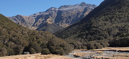
A guide to the night’s accommodation: Bobs Hut