39 tramping routes | where, oh, where to go ...
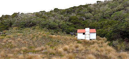
950+ backcountry tramping huts that provide an acceptable level of accommodation, at least for the unfussy.
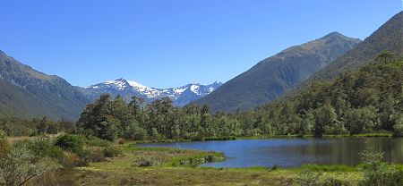
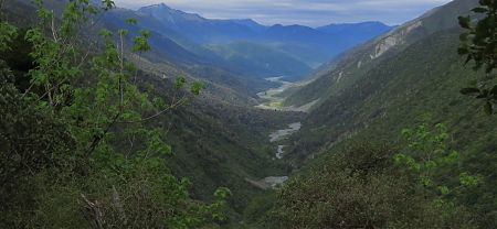
Plenty of fabbo and speccy NZ valleys to wander along and passes to climb.
So many possibilities in a variety of terrains.
The choice is narrowed down with the pragmatics: time available; access to the start and getting back to civilisation at the conclusion, in your exhilarated if someone weary state; the prospective weather conditions; etc.
Here’s the first 39 suggestions for tracks in the South and Stewart Island/Rakiura that will remove you from circulation for a week or more. And there’s always Te Araroa so that makes one more. Gunna add to the list in time . . .
The personal highlights:
The best long distance, all-season, tramp in New Zealand — North-west Circuit in Rakiura National Park, Stewart Island. Includes the best opportunity to spot a kiwi in the wild for nothing.
The best energetic overnighter around, highly debatable this one — Lake Angelus, Nelson Lakes National Park. Spend a second day and climb Angelus Peak for the full benefit. Not for winter.
Easiest beginner’s tramp with plenty of company and often spectacular coastal scenery — Coastal Track in Abel Tasman National Park.
Easiest beginner’s tramp if you prefer very much fewer companions and walking through, but not really over, the mountains — St James Walkway, North Canterbury.
The best I-want-to-get-away-from-absolutely-everyone-and-stand-on-the-edge-of-the-world tramp — Southern Circuit in Rakiura National Park, Stewart Island. Not for beginners.
Best overall bang for your money, but not in winter — Alpine Route in Mt Richmond Forest Park. Although the Lewis Pass to Lake Rotoiti runs it close. Neither are for novices or those without the full gear.
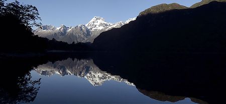
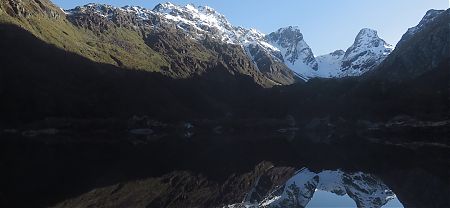
Handiest Great Walk — Kepler Track. The Milford has the reputation for the best Great Walk in the country but it’s always fully booked. Why not walk this spectacular track instead, you just stroll down to the start from the centre of Te Anau?
But my favourite might be the energetic Kākāpo River loop in Kahurangi National Park. Plenty of birdlife, including whio/blue ducks, but no kākāpo.

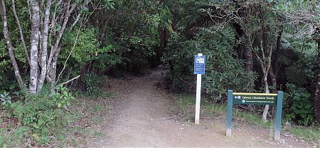
Queen Charlotte Track | Marlborough Sounds
A popular, scenic and relatively easy wander for those who enjoy camping at any time of the year.
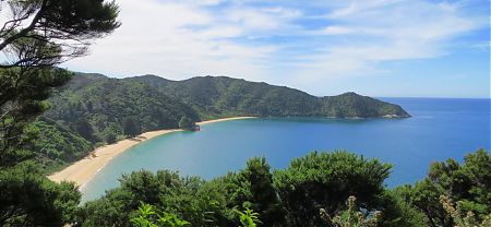
Coastal Track | Abel Tasman National Park
The Abel Tasman Coastal Track is the most popular multi-day walk in New Zealand.
Why the popularity? — It’s totally great.
Great scenery. Great accommodation. Great track.
Inland Track | Abel Tasman National Park
A more energetic variation of the Abel Tasman experience. Less congestion, slightly more adventure than the Coastal Track has to offer.
Ministry of Works Historic Hut route, Kahurangi National Park
Since the early days of the MOW Hut, say 1985 when the current hut book was established, only around 50 parties have claimed to have done the trip in either direction. 50 parties in 30+ years.
Expect to pop out the other end looking like you’ve spent time in a cage of feral cats.
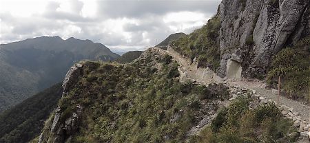
Dragons Teeth route | Kahurangi National Park
For experienced trail adventurers only, and that would be 0.001% of the population, the Dragons Teeth offers a decent challenge. This isn’t your standard DOC marked track. It sure is exhilarating up there amongst the crazy, jagged Dragons Teeth/Anatoki Peak.
Heaphy Track | Kahurangi National Park
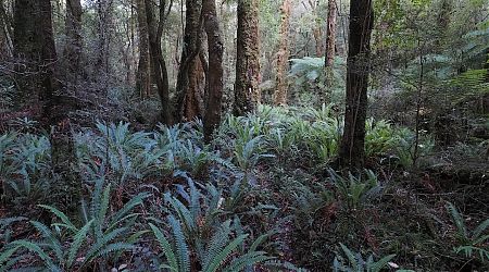
The Heaphy is the Great Walk with the most varied scenery: beech tree forest on the Takaka side; tussockland across the top; over into the West Coast forest, a different type, huge rata trees dripping with epiphytes; views of huge limestone bluffs and a creek running out from a cave; the sun plopping down into the sea; then a day walking beside golden beaches, where, if you’re lucky, you may encounter a stray seal.
Leslie-Karamea track | Kahurangi National Park
The Karamea Valley is a major treat. The beech forest is picturesque, if not pretty, and the clear green water is spectacular. Those monster trout just hover, barely sinusoidal, and if you are observant you may see 20 or more in the Karamea River. There’s evidence on show of the massive 1929 Murchison earthquake in the hills around Trevor Carter Hut, then Moonstone Lake created at that time by a humungous slip. Further down you wander past huge rimu and matai trees.
So, plenty of visual interest, a relatively easy walk, mostly down a forested river valley, although there are also a couple of above-the-treeline stretches. Good, if not great, accommodation in often newish huts. The creeks usually offering the swingbridge, rather than the wet feet, alternative. Not so much in the way of serious hill climbing, and, somewhat surprisingly, not so many others out on what could, should, be a well-utilised track.
Wangapeka Track | Kahurangi National Park
The Wangapeka Track was once one of Nelson’s premier tramps, comparable with the Heaphy, and for good reason.
Overall it’s a great introduction to tramping if you want to do something more adventurous, less populated and cheaper than the Great Walks.
Kākāpo River loop, Kahurangi National Park
For about two hours some experience in off-track full-body physicality is an advantage. It’s the West Coast, after all.
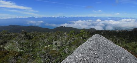
Mt Richmond route, Mt Richmond Forest Park
Exhilaration plus!! On a clear day you can see forever.
Alpine Route | Mt Richmond Forest Park
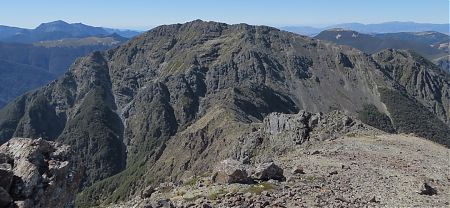
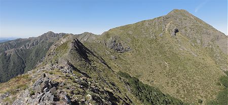
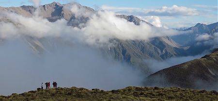
In a fine spell of weather this might be the the best tramping in the north of the South. Sometimes exhilaration requires effort, the views here, more than one 360°, are worth the toil.
Bad weather or winter trips? Not at all recommended, there are a few days oscillating around the 1500 m mark, walking on ridges, fully exposed to wind and the elements, and it can do the full-on howl up there.
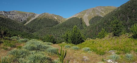
Matiri Ridge route | Kahurangi National Park
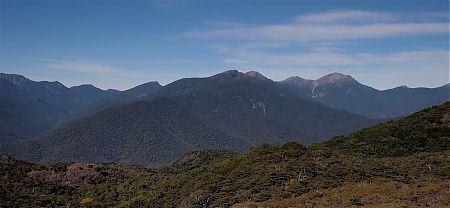
At the top of the world. No hint of civilisation in any direction. Extraordinary views of piled up hills, untracked rivers, wilderness.
On a good day travelling the, at times, semi-knife edge Matiri Ridge, from the Wangapeka Saddle to Point 1442 near Hurricane Hut in the Matiri Valley is an exhilarating experience.
Old Ghost Road, Kahurangi National Park/Lyell-Radiant Conservation Area
History, views, pristine forest, a big river gorge. The Old Ghost Road is New Zealand’s latest named track, just opened in December 2015, and offers a lot. In fact, it’s entirely audacious.
Leatham/Molesworth route | Marlborough
If you have a desire for an excursion into typical Marlborough territory, the Leatham/Molesworth route might satisfy your curiosity, as it takes in forests, alpine passes and long grassy valleys.
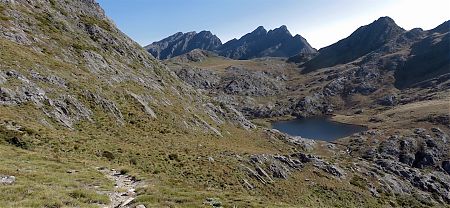
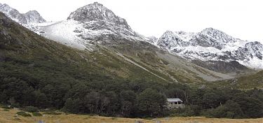
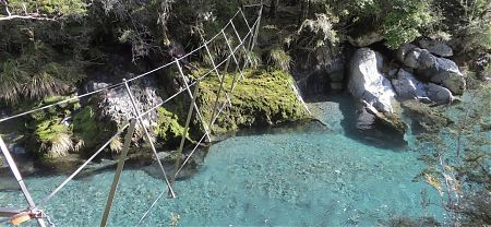
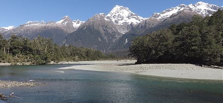
Travers-Sabine circuit | Nelson Lakes National Park
Can’t beat this circuit for a summary of what tramping in the South Island is all about: two big lakes; a mountain pass with mega views; the exquisite Blue Lake, the world’s clearest freshwater; Lake Constance for a variation on the small lake theme; a couple of long river valleys with enormous trout levitating in the cliched transparent water; big beech tree forest; ie, a huge list of sights.
If you don’t flop exhausted but buzzing onto your mattress each night you’d better check your pulse.
Nelson Lakes big circuit | Nelson Lakes National Park
There’s more to Nelson Lakes than the four day Travers-Sabine circuit, why not do the full spin of the park. That will keep you out of civilisation for a while, if you are feeling frisky.
Main features: long wanders up or down the various major valleys, the Matakitaki, D’Urville, West Sabine and Travers, through terrific beech forest and watching huge trout levitate in clear green river water. Check out the clearest freshwater in the universe at Blue Lake.
Burn/Nardoo Loop, Nelson Lakes National Park
This is a route that few people attempt. No one made an entry in the Burn Creek hut book in 2018. There was a four-year vacancy from 2002 – 2006. The track in Burn Creek is a serious challenge to follow.
East West route | Marlborough
Yeah, this is a good trip for long legged loners who like to cover terrain without tree roots, trees themselves, or other trampers.
Lewis Pass - Lake Rotoiti | Nelson Lakes National Park
A great place to find out whether extensive toil, inclement weather and inadequate food, ie, more than a little hardship, do in fact add up to the full bundle of fun.
This route gets you to some out of the way places: Bobs Hut and East Mataki Hut don’t get so many visitors, 10 parties, maybe, each year. Need any more convincing?
Paparoa Track, Paparoa National Park
A well-designed mountain bike track that is also easy enough walking for trampers.
St James Walkway | North Canterbury
A not-too-excessively challenging experience to acquaint beginners with tramping for longer than a weekend, a scenic Little Adventure through the mountains without having to actually climb them.
Harper Pass | North Canterbury/West Coast
Wow, crossing the Southern Alps.
Epic.
Harman Pass | Arthurs Pass National Park
If you want to ease your way into a West Coast tramping experience this is a great way to start.
A couple of biggish climbs, to tease your sense of adventure, snow poles where it matters, an adequate sprinkling of huts, there’s a choice of eight, and a busy highway at both ends for ready access.
Toaroha/Frew Saddles Track | West Coast
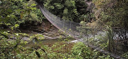
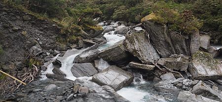
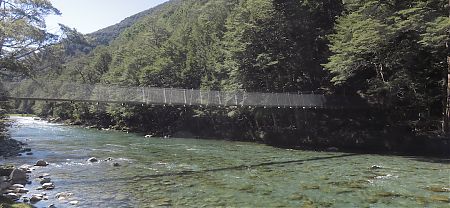
A long cableway; river travel over mossy boulders each as big as a car, a bus, a house; steep, as in very steep climbs and descents; spectacular views; big mountain river crossings; the Unclimbable Rock; high and long swing bridges; unpredictable weather, so when it rains, it really rains; and a good selection of huts.
Yup. This trip has it all. There should be no problem getting to sleep at night.
Copland Track | South Westland
Water runs into the pools at 57° C or thereabouts, and the hut warden attempts to maintain the temperature around the 39° C mark to avoid cooking weary bodies.
Haast Paringa Cattle Track | South Westland
90% of the Haast Paringa Cattle Track is super easy walking, those cattle insisted on a decent path, and the rest, well, it isn’t. Parts have been washed out, and those sections can test your average tramper.
Motatapu Track | Arrowtown to Wanaka
Don’t be mistaken by the relatively short distance, it’s actually one of the more energetic of the named tracks around. There is about 3000 m climbing involved, that’s a fair grunt, in fact little of the track is flat. Don’t bother bringing unneeded luggage.
Cascade River to Martins Bay coast route | South Westland
Only for those with good balance for the rock hopping, and the stamina to keep powering through the sloping rounded gravel beaches.
You know you need a challenge.
Pyke - Big Bay Route | Pyke Forest
Weather good: a fantastic two days.
Weather bad: don’t even think about it.
Hollyford Track | Fiordland National Park
No mountain passes, no major climbs, all creeks bridged if you class those three-wire structures as a bridge, attractive huts, the Hollyford is a go to, all year round track, unaffected by avalanches in the colder months, unlike most of the tracks in the South Island.
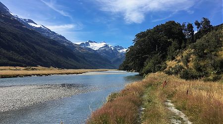
Rees Dart Track, Mt Aspiring National Park
Probably the gnarliest of the major named tracks accessible from Queenstown.
A major bonus is the daytrip on offer to the astonishing Cascade Saddle. Well, worth the effort, if the weather is good.
Routeburn Track | Fiordland/ Mt Aspiring National Parks
The major problem, there’s so much packed into a relatively short track, it is possible to walk it in a single, long, day, that those with a Destination Imperative, or simply the urge to hurry along, can wander past the highlights without giving them the attention they might deserve.
Milford Track | Fiordland National Park
In this intensely overhyped modern world it’s remarkable that there are still places of such magnificence that they transcend what is, or could be, said about them. Defy description.
Caples Track | Greenstone Conservation Area
Need to select the track to complete a loop with the Routeburn? Greenstone or Caples?
The answer: the Caples, obviously.
Greenstone Track | Greenstone Conservation Area
For newcomers to tramping this is a mighty fine introduction, you get better than average DOC accommodation, at a lower cost than the Great Walks nearby, but it isn’t the most physically challenging track around.
Mavora Greenstone Walkway | Mavora Lakes Conservation Park
All in all the views are rated Splendid, without getting into the Totally Humungously Spectacular.
Kepler Track | Fiordland National Park
The major thrill is this: there’s something special about standing high on a mountain looking down on the remote South Fiord of the lake, 1200 m below, mountains in every direction, knowing there are no towns, settlements, roads, farms, indeed only mostly wilderness wherever you gaze, basically standing on the perimeter of the Earth, looking out to forever.
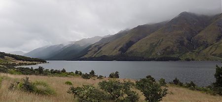
Lake Monowai, Fiordland National Park
Not for novice trampers, due to occasional track finding requirements and the generally remote nature of the area, but if you like tramping away from the crowds, with a reasonable level of energy expenditure, on relatively underused tracks, this would be an excellent choice.
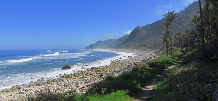
South Coast Track | Southern Fiordland
Those who are evolving webbed feet will enjoy this track. Other hardy souls may as well.
Rakiura Track | Rakiura National Park
If Stewart Island’s Northwest Circuit is like Abel Tasman on steroids, the three day Rakiura Track, much through Rakiura National Park, is a minified version: a coastal walk with views to rocky bays; big rimu/rata forest; a golden sands beach to wander down; some historic artifacts from logging days, ie, big steam engines in unlikely places; an abandoned 1870s settlement at Port William; a chance to see, at least to hear, a kiwi in the wild; splendid views of Patterson Inlet/Whaka a Te Wera; more forest, regenerating from logging 100 years ago; plenty indeed.
And all from a great track, guaranteed 99% mud free.
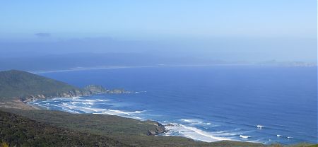
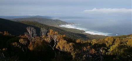
North West Circuit | Rakiura National Park
The North West Circuit appeal is this: there’s not so many places where you can wander the coastline for more than a week without intrusion by civilisation with a variety of landscapes to traverse, big tree forests with a crown fern understorey, golden sand beaches and their sand dunes, bouldery beaches, scrubby, small tree, wind shaped forest, and, at the end of the day an acceptable standard of accommodation, at least for the unfussy.
combined North West + Southern Circuit | Rakiura National Park
Hands up those who think this is the best long-distance tramp in New Zealand.
Where else can you wander around a remarkably scenic coastline untroubled by too many people, actually often no one else, no cars, no roads, no powerlines, no fences, no farm stock, no planes flying overhead, no screen interfaces, no internet or cell phone connection, often, basically no civilisation in toto except what you can carry on your back, for many days, even a week or two? A track where there are no high mountain passes, or fast-flowing mighty river torrents, to traverse and even the legendary endless river of mud seems not so troubling when in amongst it, for the most part.
Southern Circuit | Rakiura National Park
The track with the best that tramping in the Rakiura National Park has to offer — the views from Adams Hill, if you get to contemplate them with benign weather and everything around Doughboy Bay, the view from Fred’s Camp — as well as the worst — the real, bottomless bogs.
Tin Range route | Rakiura National Park, Stewart Island/Rakiura
For those who feel that Stewart Island’s Southern Circuit is not sufficiently arduous and demanding, and that would be a tiny subset of the population, there’s always the Tin Range route over to Port Pegasus for the full New Zealand tramping experience.
No track, no huts, no route on the map.