Te Araroa. One of the world’s truly great long walks.
At around 3000 km, stretching from Cape Reinga, the tip of the North Island to Bluff, the southern end of Highway 1, it rates in length.
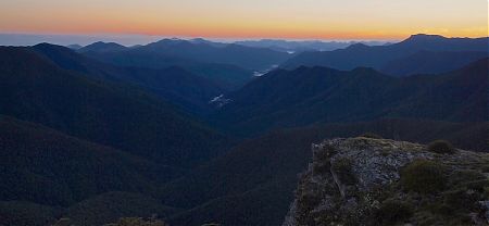
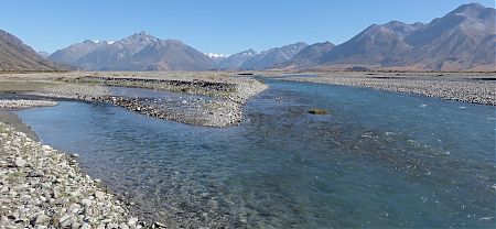
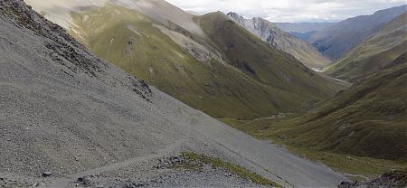
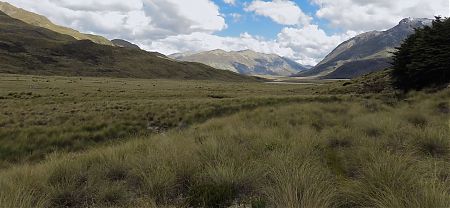
The quality of the scenery is generally up there, plenty varied.
Even the approximately 1300 km of the South Island part that this website concentrates on.
What is not apparent from the distance is exactly how new Te Araroa is as a whole. It was only finally established in November 2011.
The tracks are not always new, Te Araroa is cobbled together from existing backcountry trails, like the Alpine Route, the Two Thumbs Range, parts of old walkways, the St James and Mavora Lakes, parts of National Park tracks, from St Arnaud over Waiau Pass to Waiau Hut, and from Harper Pass to Lagoon Saddle, and various old farm tracks. But some important linking sections were needed to complete the Trail: the Motatapu and through the Takitimus and Longwood Forest.
It’s variable with the accommodation provided as well. Official campsites along the Queen Charlotte Track. Plenty of comfy ex-New Zealand Forest Service huts in the forested areas from the Pelorus River to past Hamilton Hut, you can get by without a tent if an enthusiastic walker in non-peak months. South from there the huts become sporadic with significant gaps. In Southland, there are a few days when even finding a decent tent spot near water requires ingenuity. And there is only one hut, Martins Hut, in the last 192 km, ie, once you leave Lower Wairaki Hut.
It’s a grand journey where you can settle into a routine; it’s entirely up to you how much trudging is required to feel a sense of accomplishment each day.
Te Araroa is away from digital connectivity for the most part; you can concentrate on the basics of existence and find a distraction-free perspective on life.
Because of the length, the South Island section of Te Araroa has been split into four parts, each about 300 kilometres long . . .