Low cloud was streaming past a wet tent at some velocity in the morning.
Maybe that more sheltered tent site would have been a better choice. Windy and cool. If not cold.
I lay in my sleeping bag to prepare and eat breakfast. No hurry.
Visibility would be useful for unmarked tops travel but it wasn’t to be, other than a very brief view down to the highway.
The tent was getting drier when I packed it up, but I was hoping I wasn’t going to be using it in successive nights.
I checked my progress in the fog regularly with my GPS, the ridge is very broad, consisting of plenty of small cross ridges. Without that GPS I would have been well bamboozled.
I had a thought. If it cleared there was no problem with continuing to Brass Monkey Bivvy, then, the following day, dropping down to Lake Christabel Hut to wait out the storm. If it persisted I would save Lake Christabel for another trip and drop down over the edge into Lucretia Stream, to stay in the hut there.
Well, Lucretia was marked as “hut” on my map, maybe it was a four-person hut, but even if it was a two-person bivvy I had a better chance of staying inside and avoiding the hunters.
Yup, the gloom was hanging around, I couldn’t even make out the two tarns at the top from 150 m away.
The true left looked slightly better on the map, and surprisingly there were some cairns on that side of the small creek. A faint trail dropped steeply to the second tarn marked on the map, I had assumed they were adjacent.
From there, well, there were hanging valley bluffs to descend. Those cairns continued as I picked my way, slowly, no, very slowly. It was hard making out the cairns, but I had reasonable guesswork, which some would claim as extensive trail finding expertise in such conditions. Further down, any cairns had been removed by avalanches, but somehow I made it to the bottom. Just the one retreat when I found myself looking directly over a 40 m cliff.
It sure was impressive looking back up.
Once out of the fully rocky bits I arsed some of the steeper snowgrass, holding onto the tussock as required.
Plenty of recent chamois sign, but they had vacated the area.
It took a long while to get down to the river for some boulder hopping. I was looking for a deer track, but after half an hour bashing around, leaping from boulder to boulder in the creek, I came across a permanently marked track that was getting a little overgrown. No worries, some was excellent, and it was only 1.4 km to the hut.
The two trampers I had met yesterday had stayed there before going to Brass Monkey. I might do the same if the weather tomorrow is clear.
Otherwise, I’ll just trundle over to Nina Hut for a few nights. Then it would be likely I’ll change my route to take in Devils Den and Hopeless Hut. After that, I can go over Amuri Pass.
See, I have these contingencies.
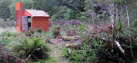
A guide to the night’s accommodation: Lucretia Hut
