After much of the day walking, I’m back again.
That’s the thing when you have to cross a tumbling waterfall, with a full spring flow.
Last night I’d been at the hut about half an hour when a hunter, Roy, came in around 7 30 pm. He’d seen a yearling deer on the track, but it was too close to shoot. Instead he dashed up to a clearing he knew and shot another yearling.
He offered me a chunk of deer liver, fresh. He was cooking it up in a lake of butter someone left behind, but I declined. Liver in butter is just a little rich for my palate and digestion.
“How about some deer heart?”
“Thanks, but . . .” I suddenly became vegetarian.
We both like a chat, and traded stories.
There were deer tracks around on the way up for kilometres along the track. They have been well exercised.
I was today.
Roy said the track would be much better for today because a small bulldozer had come through in the 1960s from the Styx River.
There were two things wrong with that statement.
I later found that the track had been dug by hand, and considerable quantities of dynamite, in the 1860s back when it was contemplated as the main highway between Hokitika and Christchurch.
And the track proved, err, variable.
The tributary creeks were washed out, and slips covered the track in various places. Add in a few windfalls, and it’s a physical exercise. Particularly when carrying more than a week of food.
At one creek it was hard to see where the track might have gone as there had been so much erosion. At one point the track just went up a steeply falling creek.
Roy had mentioned crossing a waterfall, but I didn’t pay that much attention and failed to ask too many questions.
A waterfall? It somehow didn’t sound right.
Climbing up that long creek got me on a superb section of 1860s track. I was cruising for an hour on a great piece of track.
I turned a corner and could hear the waterfall.
I had anticipated a waterfall one side or other of the track and thought I might get somewhat damp getting across.
Later I heard the crossing was called Staircase Creek. That more accurately described the situation where a considerable body of water was bouncing across rocks on a serious slope.
I put everything inside my pack, double wrapped in my twin survival bags. Coat on. Prepared to get wet.
I ventured about two-thirds of the way across. Three more steps were required, but with the agitated water I couldn’t work out where to put my hands and feet. The raging water dropped from that point more vertically, and it was clear that somehow my head was going to take the full brunt of the water flow.
Snowmelt.
I retreated.
Standing back on the same side where I started, with my bottom half soaked and cold, there seemed little choice.
Go back. 3 pm.
I’d mucked around on the way up, and it was only 2 1/2 hours back. Helped that I knew my way around the obstructions.
On my return various thoughts came to mind about alternative places to go in Arthurs Pass National Park, most of which seem difficult with the river flows. Also, I’d been there in the past.
Funny, but as soon as I reached the empty hut there seemed an obvious solution.
Return tomorrow, and maybe the flow would be less.
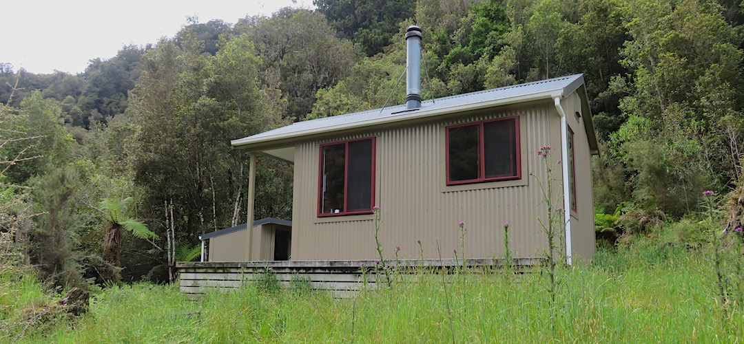
A guide to the night’s accommodation: Lower Arahura Hut