Isolated? Yeah, I had that feeling.
Up at first light and making breakfast. Before I ate my porridge, I went down to the stream and dragged three manuka saplings that had been knocked over by a flood. I cut the saplings to around 1000 mm in length, which I felt others could slice up at their own leisure. At least I got it out of the weather.
It was almost 8 am when I left to plod up the almost 400 m incline straight from the hut door. Little did I know it was going to be the longest stretch of decent track for the day.
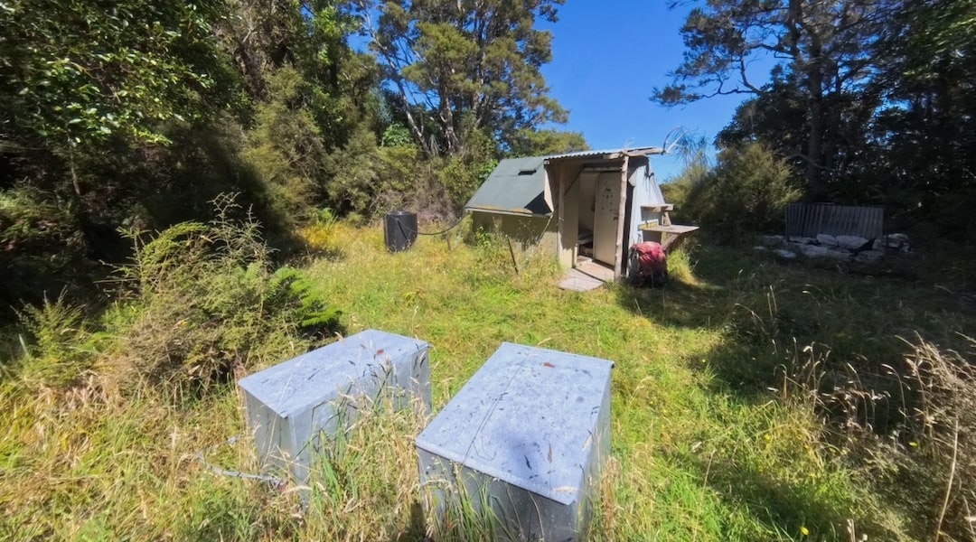
Then I lost all that elevation on the way to Brian Boru Hut. It helped that I had dumped my pack at the turn off to Napoleon Bivvy, when, after just 15 minutes at the hut, I started back up the hill.
On this excursion, for some inexplicable reason, I took my phone and watch charging cables but failed to take a battery pack, despite having three of them kicking around in my car. I found my phone battery was almost flat, which meant I couldn’t take photos, but eventually I realised I could use the Insta360 I was carrying. But I didn’t want to run that one flat, either.
The question was where to go, considering I had so little charge left on my phone, so basically not much in the way of a map. At lunchtime, I briefly turned on the phone and took photos of the Topo50 map with my 360 camera, which was permanently set to photo mode to save power.
Yeah, I’d already decided to turn off towards Napoleon Bivvy and give Zoo Hut a miss this time round. The plan was to just walk down the hill to the highway and hitch my way back. I really didn’t want to be left bamboozled about where to go on a poorly marked track if my phone battery temporarily conked out.
If I thought yesterday was scary amongst those two-storey house-sized boulders, plus all the smaller ones that had come down as part of the Kaikoura earthquake, the stress would crank up in the afternoon.
Today was different. An early scramble as I approached Ben More, with a 5 m climb in the forest, with a big drop I didn’t look at. Fortunately, there were a few shrubs to try to pull up by the roots.
It was late in the day when I reached the highest point and could look out over the scree ahead of me. Scree isn’t so bad, even on a steep incline.
The hardest part, mentally, was creeping along a series of narrow rock ledges, trying not to think about the consequences of a slip.
It looked like a 15 m drop onto a very steep scree slope that plunged down probably to the river below.
This was followed by another river of scree, then getting onto bare rock with nothing much to grab.
In such circumstances, it’s best not to contemplate the situation too much, just keep moving, and eventually it will be over.
From there, the scree channels were easier, but not easy.
Some relief when I made it into the forest, although I realised I was walking along the edge of a drop into an abyss. One short stretch was riven with big cracks, primed for letting gravity do its thing.
For some reason, I thought the ridge I had to follow would turn rounded and easy walking, but it took a long while for that to happen, and instead, there was a bunch more sidling.
I kept going on the track, which did become easier; in fact, the fastest section of the day. At times, there were views of the coast down to the Clarence River and the Seaward Kaikouras, but to be honest, I was just wondering where my accommodation was after a day of excessive effort.
Oh, there it is. Major relief.
A guide to the night’s accommodation: Napoleon Bivvy