The muscles have been well enough exercised although today was way short of yesterday’s efforts. Just the last kilometre or so was thrashing through the scrub, otherwise it was a mostly overcast day wandering along the flattish ridgetop. Two hours of actual walking that took much of the day.
Big views all around up on top of Blaikies Hill, actually massive views, it really is a treat being down here on the 47° S parallel. Just to the left was Doughboy Bay, close enough to make out the breakers on the beach, Codfish is more visible than last night, Fiordland a fainter blue in the distance, Mt Anglem visible behind Table Hill. Around to the right is the unknown area around Adventure Bay, Big Glory and Kakapoland. In the direction I’m marching Mt Allen is now visible in the Tin Range of mostly unnamed hills. It was worth just sitting out there for an hour to feel like I’m actually here, not watching some movie. After the complete lack of comfort last night it felt good just to sit and stare.
Two deer spotted today, one close at hand, startled and quickly departed elsewhere, the second with more distance, curious, stopped on the ridge to work out what manner of beast I was, then, of all things, came trotting back towards me. They were a few kilometres apart so I’m clocking them up as different sightings, the last the best view of the four deer so far. The white tails that populate Stewart Island have slight forequarters, a bigger rump, huge ears and I guess I learned why they call them white tails today, those are certainly long bushy white tails.
Moment of the day was over an hour long, just trying to work out which of the two options I should take, the vague markers, either the stone on end or a short twig poked in the sponge underfoot, had just came to a conclusion. I made a stab finally, not the direction I had anticipated the trip going but after a kilometre along the open ridgetop various vague clues indicated I was on the right path until I came across confirmation, a recent footprint.
Later I spotted few small pink ribbons, Klaartje had mentioned she’d applied some to the foliage and they were usefully positioned, just as you started the last bush bash. Talk about twiggery.
Somehow I kept more or less on the route, I’d see more footprints now and again and while it didn’t really save on the full on immersion in twiggery land at least I felt I was on the right trajectory.
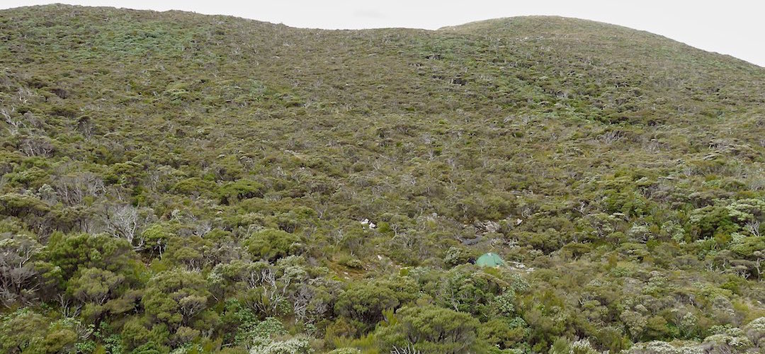
Any ambition of another hillclimb was abandoned for today when I saw that level area of dry ground, I knew I had found my night’s destination.
There’s even a couple of deep pools in this gorgeous little stream, those inclined could bathe with some exuberance. (I’ve named it Twin Pools Crossing because we are severely lacking in geographic nomenclature in this area.) That exuberance is in limited supply with this overworked body, three big days, although today’s efforts weren’t so extreme, the tide in the pack is going down but I still have 11 days food aboard.
Some spots of late afternoon rain, more than a few sandflies, so I’m inside the tent, as close to horizontal as Stewart Island allows. I note the temperature: 30° C at 4 55 pm. There’s not so much airflow and I feel like I’m back in Australia, calves sweating where in contact with my inflatable mattress. Sure is cosy.
Yeah! I’m on the level, might have a better sleep tonight.
A guide to the night’s accommodation: Twin Pools Crossing campsite