A 5 am start. Actually, I slid out of my toasty sleeping bag 20 minutes later.
One thing, it was at least 5° C warmer than the day before. I’d taken the precaution of filling up with water from the outside rainwater tank where the tap and pipes had frozen up with the heavy frost the day before.
No frost or plumes of breath this morning, maybe due to the night-time showers. It was supposed to be clearing, that would be fantastic as Doughboy Hill is 411 m. That doesn’t sound much, but it’s pretty exposed once you leave the shelter of the big rimu trees in the Rakeahua valley.
I was away before 8 am, ie, 10 minutes before sunrise, and to be honest, the day was push, push, push. Limited time sitting down.
The DOC sign outside the hut indicated 7 — 8 hours, which meant actual walking time, but I only had around 10 hours of walkable daylight at this time of year.
An hour after leaving I’d made my way through the delightfully swampy section of the old road up to the bridge over the Rakeahua River, and to the turnoff to the Tin Range. It’s not really a section you would choose to do in the dark. Another hour and I was in the open with a couple of big brown rivers of porridge to get around.
An early lunch by the river at the only possible campsite in the valley, that no one actually uses. My real lunch stop was almost 1 pm at the start of the steep climb.
By 4 30 pm, I was on the top of Doughboy Hill and it seemed easy to get down to the hut in daylight. I scoured my memory banks and came to the conclusion I had been up there on five previous occasions. The first time, back in 2004 I’d run out of camera battery by that stage and was unable to capture the view of the Tin Range with snow coating. The next four visits had all been cloudy.
This time it was perfect, or as near as perfect you get down below 47° south. The Tin Range was in full view from Patterson Inlet, Table Hill, Blakies Hill, Mount Ellis, Point 637, and even Gog and Magog in view, but they were in profile that didn’t give the pointy version from most photos.
And the tide right out down at Doughboy Bay showing the golden sand, the sun about to set in giving an orange tinge to the landscape and clouds.
I’ve finally seen the place at its best, but there was little time to linger if I wanted to avoid head torch use.
Only the 400 m drop. That took another hour and a half, and I managed to snap my walking stick in the process. It penetrated the bog-on-a-slope and snapped off where it had been damaged by my rat whacking exercise a few days earlier. No worries, I dug out the tip, some exercise due to the depth, and later hammered it in more securely, and that lasted the rest of the trip.
The sun had just gone down as I walked along the beach, but I had 20 minutes of twilight to sort myself out at the vacant hut.
I decided not to light the fire and instead head to bed and eat my dinner there.
Animals seen today: eight kākāriki, in groups of four, three, and a solitary bird. One kākā. One rat’s skin turned completely inside out.
Last, a white-tailed deer only 20 m from the hut, which took off to other parts of the island in a hurry on recognising my presence.
No one else around, and some time since anyone had been if you believe the hut book.
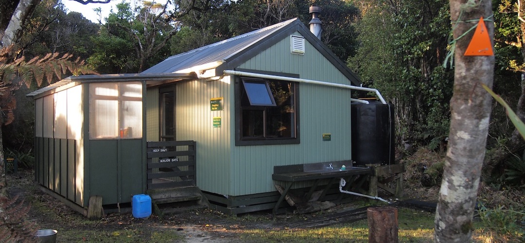
A guide to the night’s accommodation: Doughboy Hut