Location. Location. Location.
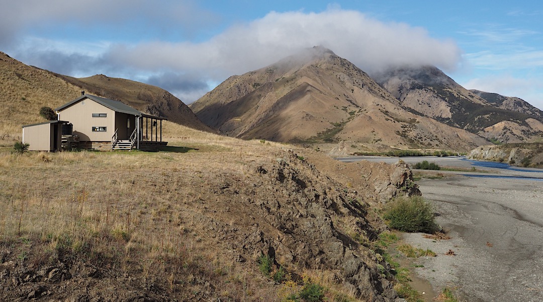
Palmer Hut, when I made it there, is perched above a bend in the Clarence River, with a view both ways, upstream and down. Plenty of windows. Oodles of space.
No one else home.
A few hunters shooting goats for DOC base themselves there sporadically, but most traffic is paddlers who stay on their first night on the river, and it seems many forget to write in the hut book.
The walk from Forbes to Palmer Huts was on a slowly deteriorating two track. Easy enough, but plenty of ups and downs.
The old farm road passes through surprisingly different geological areas, big limestone cliffs and landscape to start, then occasional outcrops of sedimentary shale, and deep red/brown ultramafic stone that little plant life can grow on.
Much of the time the track is far from the Clarence River, getting around bluffs, and in a grazing area for Muzzle Station.
The day had the now standard autumn leaden sky, and threatened rains at times, but it was mostly mizzle as the day progressed, and I slowly slowed.
From the old Willows Hut the last climb was apparent, not too bad, but the 8.5 km to go sign seemed just a bit far for that stage of the day.
Of course, there was one last rise that was attacked with weary steps before the hut was sighted on its promontory over the river.
It’s certainly a dynamic location, particularly if the river was up.
Shortly after arriving, the rain hosed down. Not sure what that would do to the rivers.
Seven hours walking, albeit on a farm road once again, and my feet deserved a rest.
A guide to the night’s accommodation: Palmer Hut