Putting in effort, such as climbing a steep road for a few hours, might seem painful, but you get some reward.
Like views initially of the blue Pacific Ocean south of Kaikoura, but once the top is reached it is looking to the hills towards the Clarence River, Mount Alarm, and Tappy. That’s Mt Tapuae-o-Uenuku, the highest New Zealand peak outside the Southern Alps at 2885 m.
The full 180° to the north had clear skies, but a cold wind from the south coated the hilltops in that direction with cloud.
At times I was in it, the cloud, and not much of the view at all.
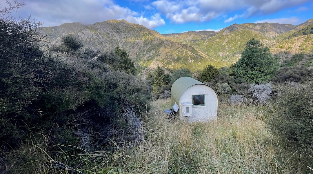
I arrived at the bivvy right on dark, so the day clearly included a fair amount of mucking around. I sat on hillsides, and then hilltops excessively, although to be honest, timing of my arrival was right on the money. Might as well enjoy the Great Outdoors as sit inside a cute little hut.
With less than a week to the autumn equinox, the days are certainly shorter, but also cooler than I’d recently been accustomed to.
My descent from Point 1354, was slow with track finding taking some concentration. Fortunately I read up on the suggested route, but on the ground that wasn’t always obvious. I could see the distinctive roof of the bivvy from on high, but it’s not A to B, with the dense matagouri requiring a detour, so in the end you approach the hut from the north.
Not for trail finding novices.
And with few visiting, it’s not like there’s a complete foot trail on the ground.
I probably should have chosen an easier start to my autumn tramping season, particularly as I was intending to do a full day of cross-country tomorrow, when I make a beeline for Alfred Hut.
This will require a descent to the Kohutara River, then climbing a reach up to around 1300 m again, before more ridge travel allows dropping into the headwaters of Alfred Stream.
A guide to the night’s accommodation: Kohutara Bivvy