Overseas versus New Zealand tracks
Overseas tracks have often developed over a long time, with significant resources. Because of their high use, these can be benched (wide enough to accommodate two people walking side by side, or at least a horse), with graded switchbacks when you need to climb over a mountain pass, and are reasonably well maintained.
New Zealand tracks are often different from what you might experience in North America or Europe.
New Zealand has three broad types of tracks.
1. Great Walk tracks. These are highly manicured, with all significant streams or rivers bridged. Often you don’t get your feet wet. DOC maintains them to provide a peak experience for people less familiar with the New Zealand backcountry. They are well marked, with signage at junctions, and markers on trees. Temporary slips and windfalls can occur in bad weather or high winds, but DOC clears them quickly. DOC focuses its efforts on maintaining these backcountry high points.
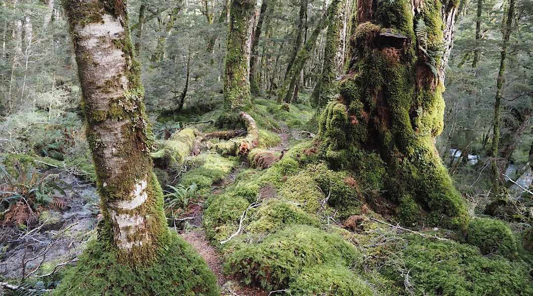
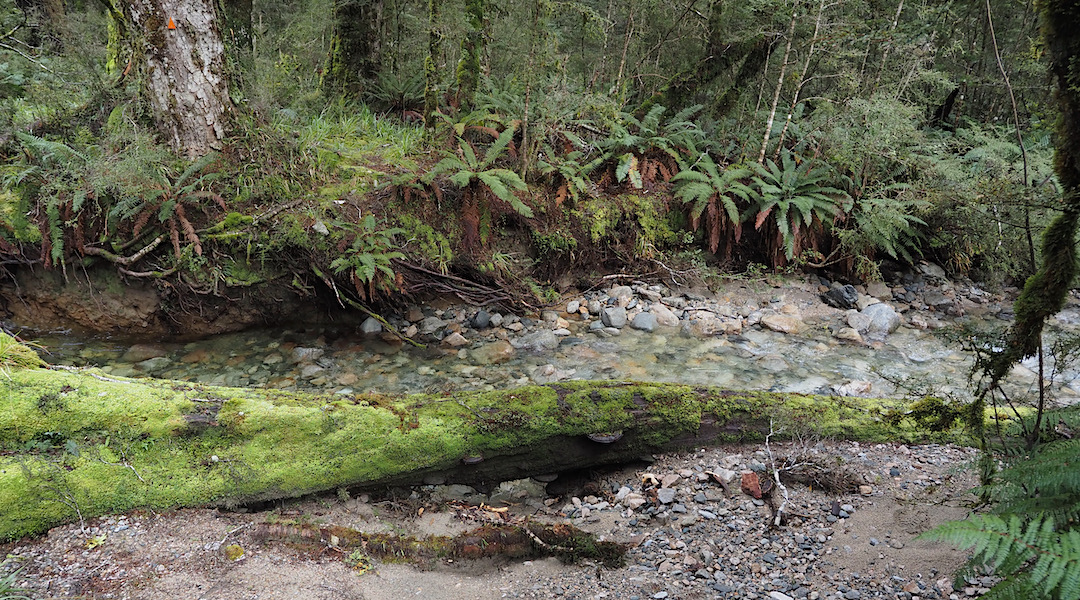
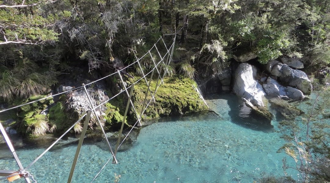
2. Named tracks. DOC also maintains the Travers-Sabine, Dusky, Leslie-Karamea, Rees-Dart, Northwest Circuit, and other tracks in national parks and conservation land, but to a lower standard. Windfalls may take months or years to be cleared. You can get your feet wet with stream crossings, or require swing or three-wire bridges to get across rivers. The tracks are generally well marked on trees or poles above the treeline, but they are not necessarily benched and can be much rougher, needing to negotiate the full tree root festival, than the Great Walk highways.
3. Other DOC tracks. These may have low usage and can vary widely in condition. DOC has abandoned many old New Zealand Forest Service tracks and only recuts them every 10 years if they’re still designated as a track, or not at all if they’re called a route. On the West Coast, the Permolat group looks after many old tracks with volunteers doing the work. Sometimes you just walk up a bouldery river, or follow occasional markers, but the route can be overgrown, and slips and windfalls are now usually circumvented rather than hacked through. Some individuals have adopted tracks and do what they can to keep them open, such as the track up to Burn Creek Hut in Nelson Lakes National Park or tracks to little-used huts in Canterbury or elsewhere. This group of tracks sometimes requires active navigation, with much of the South Island a remote obstacle course.
In New Zealand, the Great Walks are engineered and maintained to typical groomed European or American standards. Most other tracks and routes are more of a full-body workout, with those continually damp feet.
Some experienced trampers in New Zealand now carry a small folding saw and/or secateurs to trim the worst overgrown sections, spending half an hour when required to keep the track open for others rather than racing ahead and then sitting inside a hut for the afternoon. DOC lacks the funds to do anything about the state of many of these tracks.
Don’t complain, do something yourself. Even snapping twigs can make a difference if the few people passing through spend a few moments in the worst places, making the route more obvious.
Sometimes it’s up to us.

Pacific Crest Trail vs Te Araroa
Comparing two popular thru-hikes, the Pacific Crest Trail in the USA and Te Araroa, shows that conceptions of tracks differ significantly between the countries.
The PCT is a well-built, well-maintained highway for feet. TA tries to retain a wilderness experience where you use your judgement to select the best place to wade through thigh-high rivers and streams safely.
The PCT is a single, continuous, purpose-built trail with relatively gentle grades and a generally wide, smooth path, with bridges for crossing streams and rivers that keep your feet dry for days. The seasonal obstacles are real: snow and wildfires. But you can crank out 30 or 50 km day after day and don’t need much in the way of a map, as the route is well marked. Congress authorised its construction, and the President signed an Act to fund 25 years of federal government survey, land acquisition, and trail building by thousands of volunteers.
Te Araroa was developed differently. Journalist Geoff Chapple proposed the concept in a 1994 newspaper article, then walked from Cape Rēinga to Wellington in 1998, followed by the full South Island to Bluff in 2002. He wrote a book, Te Araroa, about his experience in 2002. He cobbled together existing DOC and farm tracks, forestry roads, beaches, and long stretches on public roads where landowners prohibited access. TA opened in 2011. The government was a reluctant partner that did not embrace the idea and left most of the work to volunteers. They provided $3.8 million to help build the Motatapu Track and some others, totalling around 150 km out of the full 3000 km length. The track is not continuous in conservation land and varies widely. Most TA trampers remember the deep mud, roots, boulder hopping up or across rivers. Many days you have wet feet and have to cross dozens of unbridged streams and rivers along the way. Trail finding is a necessary skill at times. Distance is measured in hours rather than kilometres, and you usually manage only 15 to 30 km a day.
The big challenges on the PCT are water carries in the desert, snowpack, altitude, and wildfires. Resupply is relatively easy, and you choose your zero days.
The challenge on TA is mostly what is under your feet: water, deep mud, roots, boulders, asphalt. Resupply in the South Island requires well-thought-out logistics.
Overseas expectations don’t match New Zealand reality. It’s a clash of fundamental track philosophies.
The PCT way of thinking is the trail as a continuous, well-engineered, and maintained path through Nature which can be traversed at speed. The continental climate makes the weather reasonably predictable. The terrain is adapted to suit the hiker.
The New Zealand track model lacks that highly engineered backcountry route. The ruggedness, mud, rivers and perpetually wet feet are aspects of the wilderness that you immerse yourself in. The tramper has to adapt to the land and whatever the weather is doing.